Tichka Est Project, Morocco
On August 18, 2020, Stellar and the Moroccan National Office of Hydrocarbons and Mines (“ONHYM”) have signed an earn-in Agreement for the exploration and development of the gold and multi-elements potential of the Tichka Est property in the Occidental High Atlas region of Morocco. The earn-in agreement is under renewal process.
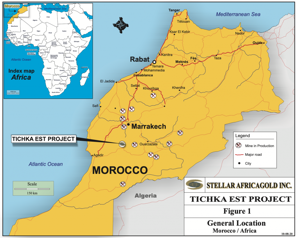
Location map of Tichka Est Project
The Tichka Est gold project, comprising seven permits aggregating 82 square kilometres, is accessible year-round by road via a national and regional road to the village of Analghi located near the mineralized gold zone. Follow-up on some strong stream sediment anomalies reported by ONHYM lead to the discovery of 2 gold mineralized structures designated Zones A and B. A new structure designated Zone C was discovered by Stellar after its own successful 2022 stream sediments program and follow-up prospecting and trenching.
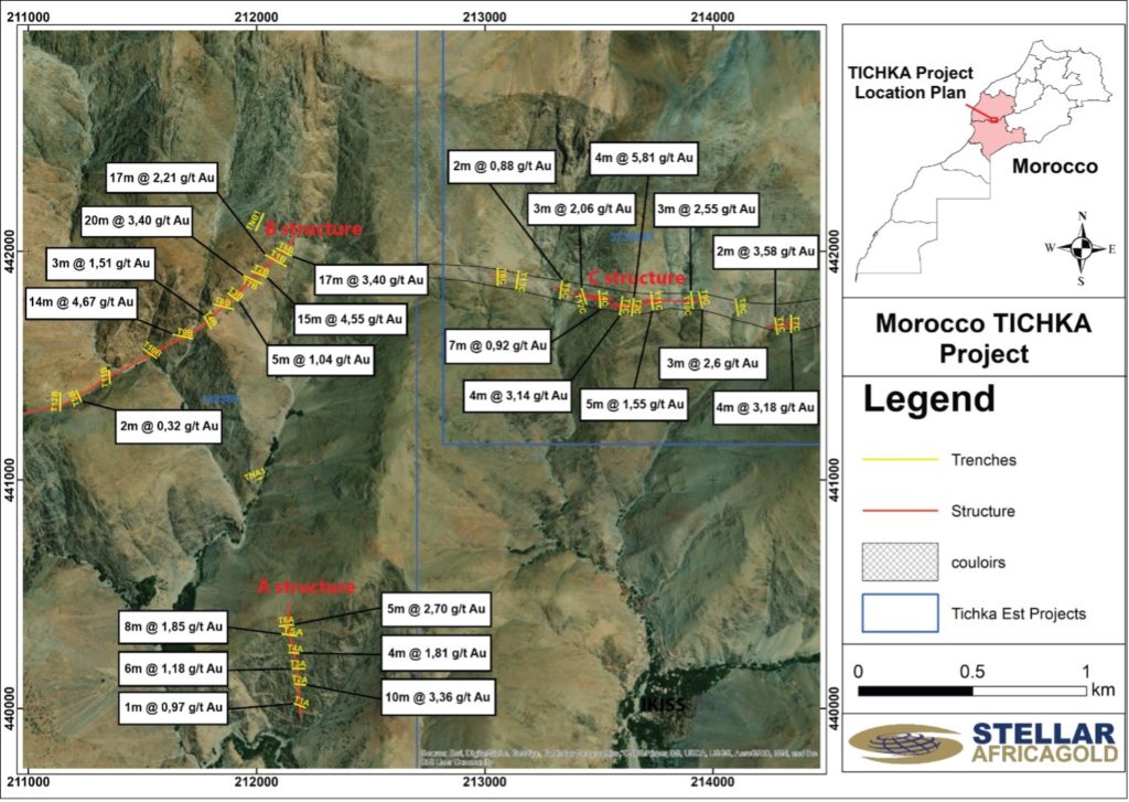
Localisation map of Zone A, B and C
GOLD MINERALIZED STRUCTURES
The Zone A structure consists of a N350° trending gold structure extending over 450 meters along strike in a shear zone at the contact of a dolerite dyke and a schist unit. The zone is injected by quartz-ankerite veins and veinlets.
The Zone B structure is located approximately 3.0 km north of the village of Analghi. The trenches across Zone B exposed a wide brecciated fault zone running ENE-WSW in a highly deformed, altered and fractured sedimentary sequence more precisely at the contact of a greenish schist of volcanic origin to the North and of a greyish siltstone to the south. The wide sheared structure is also injected with gold mineralized quartz-carbonate veins and veinlets containing disseminated and locally semi-massive pockets of pyrite and arseno-pyrite.
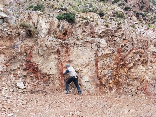
Gold Associated to Dioritic Sill Grading 3.5 G/T Gold across a True Width gf 155.7 Metres
The Zone C structure consists of a E-W trending gold structure extending over two kilometer along strike hosted in a very broken and deformed schist unit. The contact is also injected by quartz-Ankerite-sulphides with apparent pyrite, arsenopyrite, chalcopyrite and iron oxide.
ROAD CONSTRUCTION
The access road to the Tichka Est gold zones A and B is fully permitted and construction is completed.
This access road of approximately 7.5 kilometers on mountainside (see Figure below) is equivalent to 7.5 km long trench within the area of the Tichka Est Gold Project. The entire alignment of the road is within the periphery of Stellar’s permits so, in addition to providing drill site access, the road cut provides valuable geological information across the lithology of the property and exposed additional new structures.
The road will enable the access of drilling machines to drill Structures A and B.
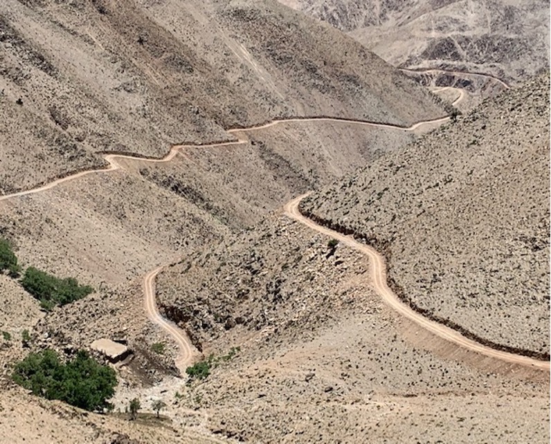
Road Photo
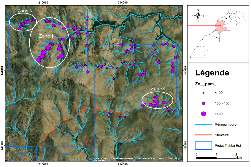
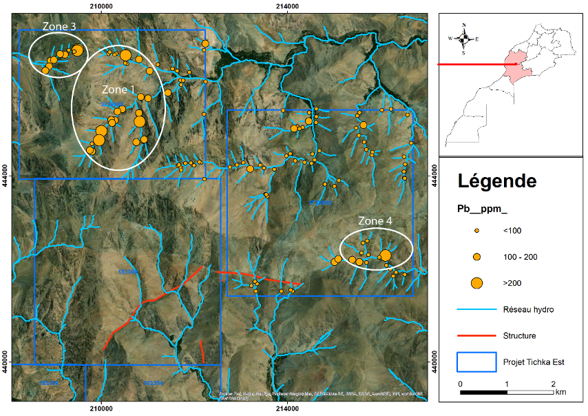
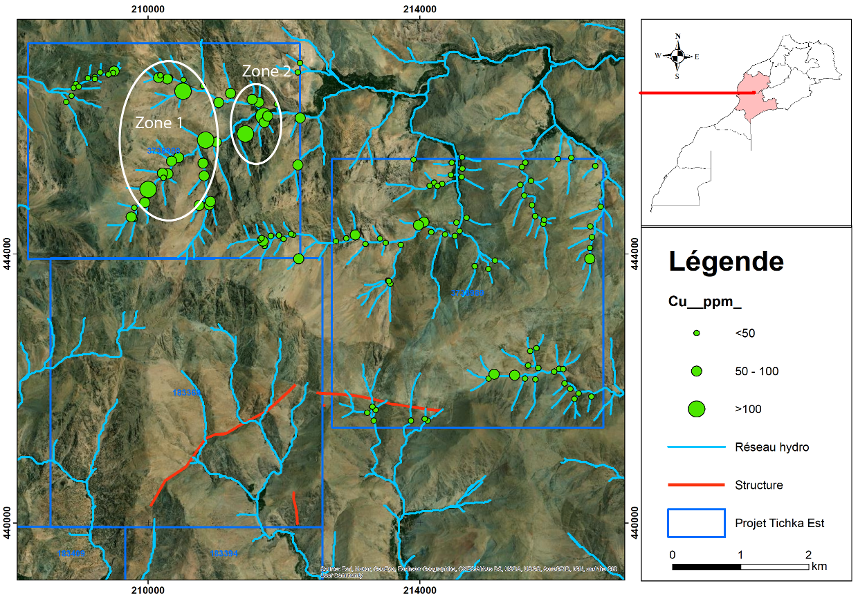
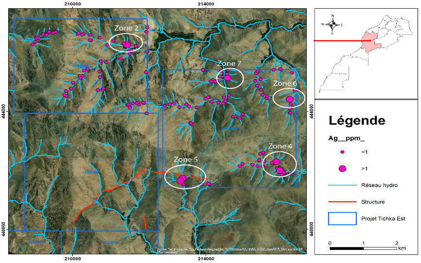
Stream Sediment Sampling Program
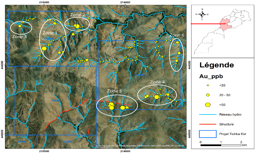
The stream sampling program on the new acquired permits revealed seven zones of anomalous mineralization including both precious and base metals. The seven anomalous zones included combinations of gold, silver, copper, lead and zinc and each zone includes from two to five minerals except Zone 7 which is purely a silver anomaly.
Technical Information and Quality Control Notes
The assay results referenced in this news release were prepared in accordance with National Instrument 43-101 Standards of Disclosure for Mineral Projects. The sampling of, and assay data from, channel chips samples is monitored through the implementation of a quality assurance – quality control program designed to follow industry best practice.
Sample collection was done by two local experienced senior geologists under the supervision of Yassine Belkabir, MScDIC, CEng, MIMMM, Stellar’s Director and QP in Morocco, and Dr. Ali Saquaque, Stellar’s Technical Advisor for Africa. Channel sampling of each mineralized section encountered in the different trenches was done at surface across exposed sections of mineralized structures. Each sample collected weighed approximately two kilograms and is a representative composite of the material within this interval. The samples were bagged on site and stored in safe areas until being transported to African Laboratory for Mining and Environment (“Afrilab”) in Marrakech for analysis.